The round barn at Fountaingrove became an image of loss after the 2017 firestorms. In 2018, the Museum of Sonoma County's Lost Santa Rosa exhibition placed photographs of the burning landmark alongside the collapsed county courthouse after the 1906 earthquake: recognizable structures through which a city registered abrupt change.[2]
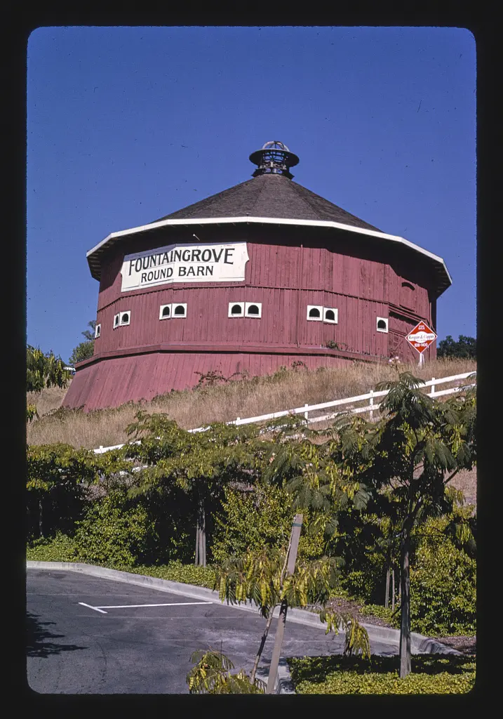
Margolies had photographed the barn in 1991.[1] His earlier image allows the structure to be encountered before disaster became its defining public association.
The barn's named shape made it distinctive within an everyday landscape. 'Round barn' is already a description that can function as a landmark, separating one agricultural structure from the rectangular buildings many viewers expect. Familiarity with such a form can become part of knowing a route or recognizing an approach to a city.
Curated by Eric Stanley, Lost Santa Rosa considered several kinds of urban change. Alongside disasters, it examined neighborhoods displaced by Highway 101, demographic shifts, deliberate decisions, and neglect.[2] The exhibition placed the barn within a broader history of how places disappear for different reasons.
That context gives the earlier photograph another use. It preserves a view of the building without requiring the viewer to begin with the fire. The landmark can still be considered as a shape, an address, and a part of Santa Rosa's visible landscape.
After a loss, photographs take on some of the work once performed by the place itself. They offer a point of recognition for people who knew it and an introduction for those who did not. Margolies's record and the later exhibition serve those different encounters: one fixes the barn in 1991; the other explains why its absence became part of the city's collective account of change.